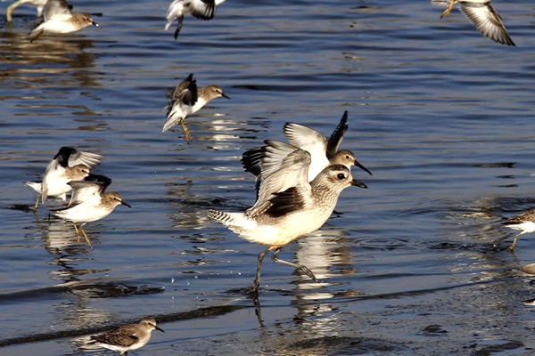
Volunteer surveyors are the heart of the Pacific Flyway Shorebird Survey.
We invite volunteers to take ownership of a survey route and then cover the route each year. Take part in the conservation of shorebirds and their habitats by contributing to a long term monitoring program.
See the below requirements and then contact the appropriate person for your desired survey in the table below or find the contact person for your country on our Steering Committee page. If you can’t find what you’re looking for, you can also contact Matt Reiter at mreiter@pointblue.org.
A long-term monitoring program, led by Point Blue Conservation Science, that is designed to guide the management and conservation of wintering shorebirds. A vast network of volunteers and professional biologists combine to conduct a survey that provides a snapshot of the Pacific Flyway every year.
The Pacific Flyway Shorebird Survey (PFSS) and the Migratory Shorebird Project (MSP) combine to monitor populations of migratory shorebirds across all 13 countries of the Pacific coast of the Americas. Use the Explore data tab above to see survey locations and preview results.
Shorebird survey protocols, trainings, datasheets, and data entry applications are available in English and Spanish.
Data available online here: Explore Data. Data are stored in the Avian Knowledge Network. This cross-organizational database is hosted by Point Blue and provides a secure, well-tested platform for storing, managing, analyzing, and visualizing ecological monitoring data.
Questions?
Please contact us! Matt Reiter at mreiter@pointblue.org or Blake Barbaree at bbarbaree@pointblue.org.
A new initiative to monitor the shorebird population across interior wetlands and saline lakes of the Intermountain West. Learn more at www.imwss.org
Time Commitment:
~2 days each year:
Training: Attend a protocol training session or watch the online training video prior to the survey.
Scouting: Become familiar with your site, make sure you know the access points and how long it will take to cover the area.
Survey: One day between November 15th and December 15th (a specific date may be chosen by the survey coordinator).
The best candidates for the project will:
Survey areas are listed from north to south along the US West Coast
| Survey Name | Contact Name | Contact Email |
| Puget Sound Shorebird Survey (WA) | Gary Slater | glslater@ecoinst.org |
| Grays Harbor Shorebird Survey (WA) | Vanessa Loverti | Vanessa_Loverti@fws.gov |
| Willapa Bay Shorebird Survey (WA) | Vanessa Loverti | Vanessa_Loverti@fws.gov |
| Columbia River Estuary Shorebird Survey (WA/OR) | Vanessa Loverti | Vanessa_Loverti@fws.gov |
| Yaquina Bay Shorebird Survey (OR) | Cheryl Strong | cheryl_strong@fws.gov |
| Coos Bay Shorebird Survey (OR) | Blake Barbaree | bbarbaree@pointblue.org |
| Humboldt Bay Shorebird Survey (CA) | Sean McAllister | whiteouters@gmail.com |
| Central Valley Shorebird Survey (CA) | Blake Barbaree | bbarbaree@pointblue.org |
| Tomales Bay Shorebird Survey (CA) | Emiko Condeso | emiko.condeso@egret.org |
| Point Reyes Estero Shorebird Survey (CA) | Mark Dettling | mdettling@pointblue.org |
| San Francisco Bay Shorebird Survey (CA) | Mark Dettling | mdettling@pointblue.org |
| Elkhorn Slough Shorebird Survey (CA) | Susie Fork | skfork@gmail.com |
| San Diego Bay Shorebird Survey (CA) | Mark Dettling | mdettling@pointblue.org |
| Salton Sea Shorebird Survey (CA) | Blake Barbaree | bbarbaree@pointblue.org |